EROAD Truck, Traffic & Satellite Map Layer displays useful information on the Activity screen map, that helps you better plan journeys and improve productivity.
Route planning is essential to ensure the safe and efficient movement of your fleet. Trip information and real-time visibility into the location of your vehicles allows you to better manage risks and improve safety.
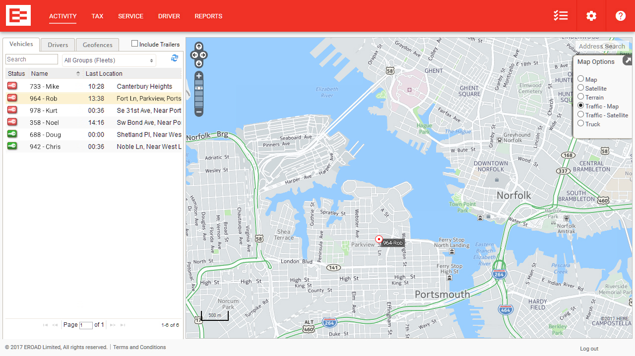
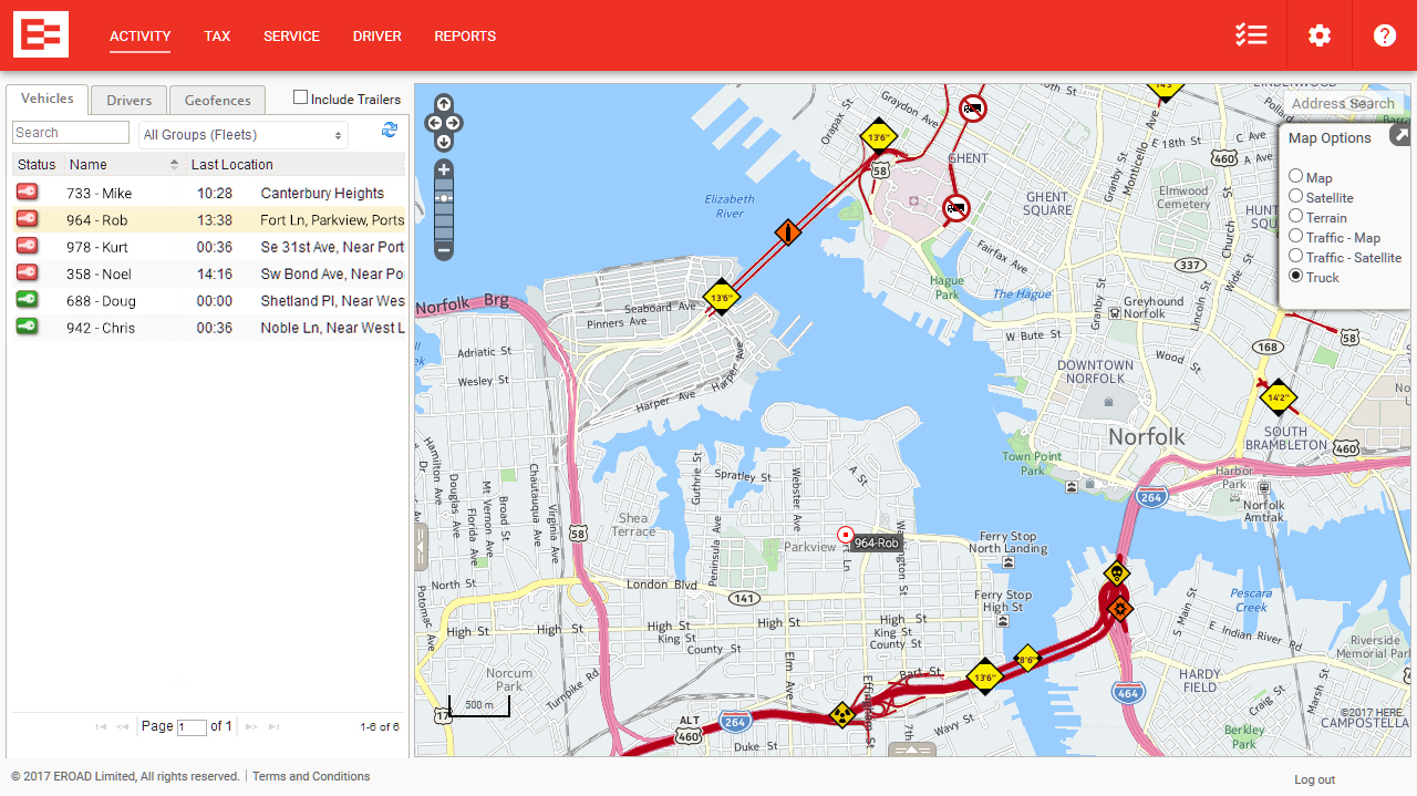
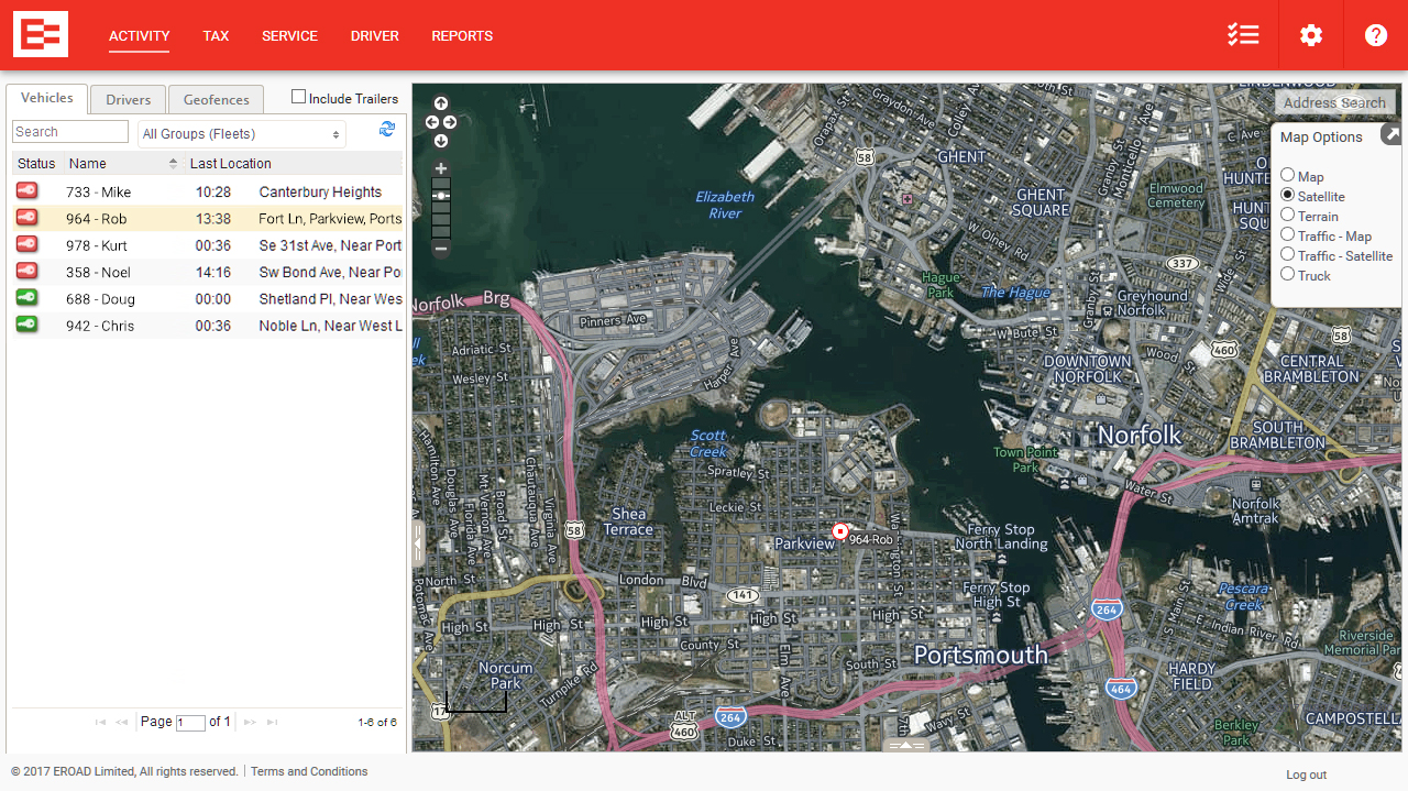
EROAD Truck, Traffic & Satellite Map Layer displays information on the Activity screen map in EROAD’s web application, Depot, which you can use to plan your journey. Multiple map options include physical and legal restrictions for vehicles and loads, warnings for roads, traffic flow and other geospatial options. Your dispatchers can quickly and easily view the height, weight, width and length restrictions for a journey, and plan journeys using traffic flow information. You can also create geofences to help monitor restricted and high risk routes.
KEY FEATURES

Our customers rely on EROAD to ensure FMCSA compliance with the ELD mandate and on our platform to deliver the accurate and reliable data that helps them run a faster, safer and more successful business.
Start your journey with EROAD today.